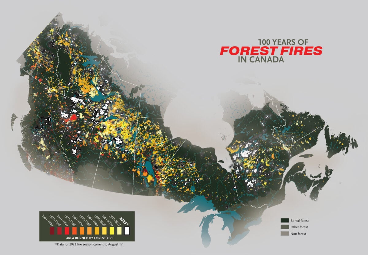
It’s weird, and perhaps deceptive, how untouched northeastern Ontario appears on that map (not 100% sure, but they appear to have failed to map out the Great Fire of 1922, even though it falls just within the timespan in their map legend). We’ve been lucky these past few seasons, though.
Their marking of the forest/non-forest boundary is also deceptive—it makes it look like the area around Lake Nipissing isn’t forested. It is.
I interpreted the map to be non boreal, not unforested. If you look at Northern Québec where it is unforested it’s a different shade of grey. I think they could have done better colour selection.
Possibly, but does the boreal/non-boreal forest distinction really matter? I don’t think there’s anything that makes non-boreal forest much less likely to burn if exposed to an ignition source.

It’s weird, and perhaps deceptive, how untouched northeastern Ontario appears on that map (not 100% sure, but they appear to have failed to map out the Great Fire of 1922, even though it falls just within the timespan in their map legend). We’ve been lucky these past few seasons, though.
Their marking of the forest/non-forest boundary is also deceptive—it makes it look like the area around Lake Nipissing isn’t forested. It is.
So not that good a map.
I interpreted the map to be non boreal, not unforested. If you look at Northern Québec where it is unforested it’s a different shade of grey. I think they could have done better colour selection.
Possibly, but does the boreal/non-boreal forest distinction really matter? I don’t think there’s anything that makes non-boreal forest much less likely to burn if exposed to an ignition source.
No clue there!